
Today's Best Fishing Times
Get the best fishing times for Lake Monongalia with Lake-Link's Fishing Forecast. SEE MORE
Share Your Catch & Win!
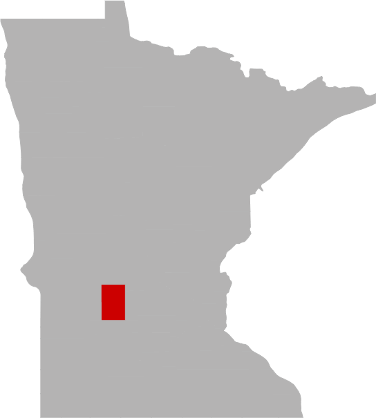
Frequently Asked Questions About Lake Monongalia, MN
- How big is Lake Monongalia?
- How deep is Lake Monongalia?
- What kind of fish can you catch in Lake Monongalia?
- What are the closest cities to Lake Monongalia?
- Are there places to stay in the Lake Monongalia area?
- Are there boat launches on Lake Monongalia?
- Are there places to eat and drink near Lake Monongalia?
- What is the average air temp for Lake Monongalia?
- Are there any state parks near Lake Monongalia?
How big is Lake Monongalia?
How deep is Lake Monongalia?
What kind of fish can you catch in Lake Monongalia?
Other fish species in the lake include Bluntnose Minnow, Golden Shiner, Green Sunfish, Hybrid Sunfish, Tadpole Madtom and White Sucker.
What are the closest cities to Lake Monongalia?
Are there places to stay in the Lake Monongalia area?
More Lodging Options
Are there boat launches on Lake Monongalia?
Are there places to eat and drink near Lake Monongalia?
History & Status of the Fishery
A resurvey of Middle Fork Crow Reservoir "MFCR", also known as Monongalia or Mud Lake, was conducted in June of 2013. MFCR is a large (1,565 acres) and productive reservoir located in Kandiyohi County with three distinct basins starting upstream to downstream include: Mud Lake also known as Monongalia, the reservoir, and the Mill Pond located within the city limits of New London. Residential development (176 homes/cabins) has occurred primarily along the west shoreline and bay areas of the reservoir portion adjacent to the city of New London. There are four public access sites located adjacent to the MFCR basins, which include one on the north shore of Mud Lake basin, two adjacent to the reservoir basin and one on the Mill Pond basin. The MFCR maximum depth is 14 feet, which occurs in the Mill Pond basin near the New London Dam. The depth in Mud Lake basin is usually less than 4 feet with abundant aquatic vegetation and limited development. The reservoir basin maximum depth is about 6 feet deep with development primarily along the west shores with relatively undeveloped hardwoods and wetlands along the east shore. Water quality (total phosphorus=0.036 mg/l) was moderate during June of 2013 for MFCR. Water clarity was moderate (7.6 feet) during June of 2013. A helixor aeration system operates in the mid-portion of the reservoir basin during the winter months. Partial winterkills are frequent occurrences during winters with abundant snowfall accumulations. Low dissolved oxygen and the release of high levels of hydrogen sulfide can also be persistent problems during the late winter/early spring months for MFCR basins. Storm water and residential lawn runoff from the city of New London and residential homes enters the reservoir portion. Agricultural row crop drainage into the MFCR occurs via several inlets/tiles, but mostly into the Mud Lake basin. The Middle Fork Crow River enters Mud Lake basin near the north shore, flows through Mud and into the reservoir basin, then Mill Pond, and eventually outlets at the New London Dam (southwest portion of Mill Pond). The New London Dam was replaced in 2010. It is a formidable fish barrier and is classified as a high hazard dam. The Middle Fork Crow River eventually flows into Nest Lake, Green Lake and Calhoun.
Emergent vegetation (cattail species, wild rice, waterlily species, etc.) densities were prevalent within the MFCR, especially in the Mud Lake basin. Submergent vegetation species are varied and often dense within the basins. Submergent vegetation densities were lower in 2013 and 2008 compared to 2003, especially within the Mud Lake basin. Boat travel was almost impossible during 2003 due to abundant vegetation, unlike 2013. Approximately 40 species/groups of aquatic vegetation were observed during the 2013 vegetation transect survey. The most commonly occurring submergent species present within the MFCR basins were water celery, sago pondweed, coontail, clasping-leaf pondweed and northern milfoil. Other abundant algal/floating/submergent species observed included muskgrass, lesser duckweed and various pondweed species. Intense filamentous algae blooms are common by early July. The most commonly occurring substrates included sand, detritus, muck, and silt. MFCR is also a popular fishery for northern pike, sunfish and largemouth bass.
Largemouth bass were not captured in either gillnets or trapnets during the 2013 or 2008 MFCR resurveys. Largemouth bass were captured in low numbers during other previous surveys and assessments.
Black crappie numbers were low in 2013 (0.93 fish/trapnet) compared to the normal range for similar lakes. The black crappie gillnet historical average catch rate was 0.78 fish/trapnet. The 2013 black crappie average size was moderate (0.44 pounds and 8.64 inches) from trapnets. Black crappie growth rates in MFCR were below the Spicer Area normal range for age 1 and near upper ends of the normal ranges for ages 2-6. The 2011 black crappie year class comprised 50% of the 2013 total black crappie catch. Black crappie adults were recently stocked in 2008 (468 fish, 117 pounds), 2010 (1,056 fish, 264 pounds) and 2011 (944 fish, 236 pounds).
Northern pike numbers were high in 2013 (11.23 fish/gillnet) compared to the normal range of similar lakes and the MFCR historical average (9.68 fish/gillnet). The 2013 northern pike average size was small (1.68 pounds and 19.10 inches) from gillnets. Abundant stunted northern pike numbers have been the norm due to abundant spawning habitat and limited preferred prey species (yellow perch). The northern pike historical average weight is 1.46 pounds from gillnets. The 2013 catch rate of northern pike >21 inches was fair (2.67 fish/gillnet). However, the 2013 catch rate of larger (>28 inches) northern pike was low (0.20 fish/gillnet). Northern pike growth rates in MFCR were below the Spicer Area normal ranges for ages 1-8. The 2011 and 2010 year classes comprised 54% and 20% of the 2013 northern pike catch.
Yellow perch numbers were low in 2013 (0.67 fish/gillnet) compared to the normal range of similar lakes and the historical average (3.29 fish/gillnet). The 2013 yellow perch average weight (0.17 pounds) was moderate from gillnets. Yellow perch growth rates in MFCR were below the Spicer Area normal range for age 1, but within the normal ranges for ages 2-5. The 2007-10 year classes each comprised 33% of the 2013 yellow perch catch. Yellow perch were recently stocked in the 2013 fall (13,494 fish, 519 pounds).
Walleye numbers were low in 2013 (2.00 fish/gillnet) compared to the normal range for similar lakes. The walleye historical catch rate is 1.83 fish/gillnet. The walleye average size was moderately large (2.00 pounds and 17.59 inches) in 2013. The walleye historical average weight is 2.10 pounds from gillnets. Walleye growth rates were above the Spicer Area normal ranges for ages 1-5. The 2010 year class comprised 43% of the 2013 walleye catch. MFCR was stocked recently with 0.5 million walleye fry per year during 2009-2011 and 0.1 million fry during 2012.
Bluegill numbers were low in 2013 (0.40 fish/trapnet) compared to the normal range of similar lakes and the MFCR historical average (6.70 fish/trapnet). The 2013 bluegill average size was large (0.35 pounds and 6.76 inches) from trapnets. The bluegill historical average weight is 0.24 pounds from trapnets. Bluegill growth rates in MFCR were above the Spicer Area normal ranges for ages 1-7. The 2011 and 2010 year classes comprised 50% and 33% respectively of the 2013 bluegill catch. Bluegill adults were last stocked in 2004 (1,365 fish, 195 pounds).
Pumpkinseed sunfish numbers were abundant in 2013 (9.20 fish/trapnet) compared to the normal range of similar lakes. The pumpkinseed sunfish historical average catch rate is 6.56 fish/trapnet for MFCR. The 2013 MFCR pumpkinseed sunfish average size was moderate (6.39 inches and 0.24 pounds) from trapnets.
Hybrid sunfish abundance in 2013 (1.07 fish/trapnet) was below the historical average (1.97 fish/trapnet) in MFCR. The hybrid sunfish average size was large (7.16 inches and 0.39 pounds) in 2013.
Black bullhead numbers were abundant in 2013 (64.00 fish/gillnet) compared to the normal range of similar lakes. The black bullhead historical average catch rate is 37.74 fish/gillnet for MFCR. The 2013 black bullhead average size was small (0.21 pounds) from gillnets.
Yellow bullhead numbers were also abundant in 2013 (13.67 fish/trapnet) compared to the normal range of similar lakes. The 2013 yellow bullhead average weight was moderate (0.37 pounds).
Other fish species of interest captured in the 2013 included abundant numbers of carp (5.07 fish/trapnet) and moderate numbers of white sucker (2.33 fish/gillnet). The carp and white sucker historical average catch rates were 3.08 carp/trapnet and 2.74 white sucker/gillnet for MFCR. The 2013 carp and white sucker average weights were 5.91 pounds and 2.14 pounds respectively.
Current fish management activities on MFCR include monitoring the fish population on a periodic basis, monitoring winter dissolved oxygen levels, assisting local residents and Kandiyohi County in the operation of the aeration system, protecting native aquatic vegetation through the permit process, preventing and educating about the spread of invasive species, participating in local watershed initiatives, and stocking various fish species as warranted. The MFCR fishery will be assessed in the 2018 summer for all fish species.
What is the average air temp for Lake Monongalia?
Are there any state parks near Lake Monongalia?
For more Minnesota State Park information see our State Park Guide.
More Nearby Lakes To Explore
There's more lake's to explore around Lake Monongalia...| DISTANCE | ACRES | MAX DEPTH | |
| Bear Lake | 3.2 mi | 133 | 21 ft |
| Long Lake | 3.5 mi | 325 | 46 ft |
| Nest Lake | 4.4 mi | 1,008 | 40 ft |
| Green Lake | 5.1 mi | 5,561 | 110 ft |
| Andrew Lake | 5.2 mi | 736 | 26 ft |
| Unnamed Lake | 5.2 mi | 28 | 9 ft |
| George Lake | 5.9 mi | 228 | 34 ft |
| Calhoun Lake | 6.1 mi | 647 | 13 ft |
| Middle Lake | 6.7 mi | 368 | 11 ft |
| Henderson Lake | 6.9 mi | 75 | 57 ft |