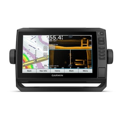
HOME
LAKES
REPORTS
FORUMS
TRAVEL
DEALS
SEARCH
MORE
Fishing Equipment

Navionics+

2/29/16 @ 5:50 PM
INITIAL POST
A5¢
A5¢
PRO MEMBER User since 6/15/09
I got an Elite 7ti locator. There is a ton of bells and whistles and plenty of options and accessories. I also purchased a Navionics+ mapping chip. I plugged it in and I was very disappointed when there was very poor graphics. To make a long story short, the Lowrance maps were far better. Navionics lets you live scan while fishing and download the lakes details and save them. So what you are doing is making your own map from a nearly blank chip. If you add it to "community", the information is shared with others that have scanned different waters and you can get what they have found. It seems to me, that I paid $170 to download information in order to build maps for them. So if you are thinking about a map chip that is "plug and play", this is not the chip you want. However, if you want to create your own maps, this would be a very good way to go.
Displaying 1 to 15 of 18 posts
2/8/19 @ 11:51 AM
Junkie4Ice
Junkie4Ice
User since 12/19/11

eyelooking - I sent you a PM with my email for the video. I do have the paid version and am able to get 1-2 colors working at a time. I think my issue is that I am putting the ranges over-lapping rather than cutting them off at the next color depth.

2/7/19 @ 3:19 PM
eyelooking
eyelooking
User since 2/28/05

Kvan...This site will not let me share a video. If you have messenger you can message me and I can send you the video. My name is: Gregory Ollila on Facebook. Thanks!

2/7/19 @ 2:27 PM
eyelooking
eyelooking
User since 2/28/05

Kvandehei33...I can help you set it up. I will also attempt to add a video on how to do it also.This will only work on the paid version and not the free version. You must get the $14.99 app (year) to use the color shading.

Go to the Navionics app

Hit the menu button

Scroll down to map options and click on that

Scroll to Fishing Ranges and turn on

There are 5 color shading ranges that you can use

Example how mine is set up: 0-5, 6-20, 21-40, 41-60, 61-70


 I am trying to upload that video link so check back later. Thanks!


2/7/19 @ 9:45 AM
Junkie4Ice
Junkie4Ice
User since 12/19/11

I'm struggling to set up the different colors for different depths. Do I need to set the depth ranges so that they don't overlap? Is there I limit on how many colors I can use? Any help is appreciated! Would be nice to get some color coding!

2/6/19 @ 3:05 PM
eyelooking
eyelooking
User since 2/28/05

I do the same using the Navionics mobile app. It works awesome.

1/22/19 @ 11:29 AM
eyelooking
eyelooking
User since 2/28/05

OK Chumley....make she you hit the update all button under the menu tab everytime you go into the app. Thanks and tight lines.

1/22/19 @ 9:01 AM
Chumley20
User since 1/30/18

eyelooking, thanks for your reply!  I have the app on my iPhone, but i've noticed the the Navionics map is different than the Sonar map.  You can flip between the two and notice the difference in contours for any given lake.  Not sure if you have noticed that in the lakes you fish, and perhaps it's different for each lake. 

1/21/19 @ 6:22 PM
eyelooking
eyelooking
User since 2/28/05

Chumly 20...When I ice fish I use the Navionics mobile app with GPS. If you don't have it you can get it for $10 a year on your Iphone or Android device. What I like about the app is you can adjust the water depths under the menu option. Right now the water is high and you could adjust for it to make the map more accurate, The app also allows you to make the color shading depths which is also great. It also allows you to make community edits on the map. Some plotters will not allow you to make community edits where the app will.

1/21/19 @ 3:46 PM
Chumley20
User since 1/30/18

What map option do you all typically use for ice fishing between the Navionics Chart and the Sonar Chart? 

I find that there are some pretty drastic differences between the contours of each and that can play a huge role in targeting a drop off, hump, etc.  Last weekend I fished what I had thought was going to be a 13-15' hole (it showed up as so on Sonar chart) however my flasher and the Navionics chart read 7-9'.  The Navionics chart seemed to be more accurate in terms of what my flasher was showing me.  You would think the Sonar chart is the most accurate and up to date given the added details shown on the map via contours, however perhaps the Sonar chart is only as good as the data being recorded which could be inaccurately done.   

I'm going to chalk this up as a lesson learned and instead of utilizing solely the Sonar chart, perhaps I should utilize both along with my flasher to get the best results.  Anyone care to share there thoughts on this matter and what works best for you? 


10/8/18 @ 2:01 PM
eyelooking
eyelooking
User since 2/28/05

https://youtu.be/BdYt0GmgLiM

On a Lowrance plotter you need to go to the menu and select chart options and then select sonar to get the 1 ft contour mapping. I always recommend updating your card for the water you are fishing prior to hitting the water for the most updated detail. I would also recommend getting the Navionics USA Boating app for your phone for $10. Its a great back up if your plotter should go down and you you can view any body of water anytime anywhere. Tight Lines to you! #Navionics

6/22/16 @ 7:24 PM
KirtHt
User since 8/31/12

You need to download the High Definition SonarChart layer to the card, the data that comes on the card is the base or Gold level mapping. The SonarChart layer is the mapping layer that Navionics updates when new mapping data is available the dynamic layer. Then every month or so you can update the SonarChart layer buy what is call the Freshest Data program. 

Here are some examples of the St Croix. You can view all of Navionics mapping online on the Navionics website on the web app they give you both views click on the sonar icon lower left 

3/1/16 @ 8:57 AM
A5¢
A5¢
PRO MEMBER User since 6/15/09
There is a button on Navionics web site that made mention of it.
3/1/16 @ 8:48 AM
slipery
slipery
User since 1/30/11
Can I upgrade my Lake Maps Chip that I purchased back in the 90s ?
3/1/16 @ 8:15 AM
markrazzy
User since 6/23/09
Make sure you have the elite 7 reading your chip. You need to go into options and select "fish n chips" or something like that. I have an elite 5 chirp on my kayak along with an old navionics+ chip that I update and I've also got into mapping smaller lakes using insight genesis (lowrance's version of making your own maps). Making your own maps is especially sweet on bodies of water where HD maps don't exist. Helped me catch some walleyes this winter by finding some structure nobody else knows about.
3/1/16 @ 8:03 AM
A5¢
A5¢
PRO MEMBER User since 6/15/09
I plugged the card reader into my computer, went 5o their web site, hidh lighted the area I wanted to down load and clocked start. After it was done, I put the chip into the locator, went to the area that in had high lighted and there was no change. I watched a ten minute you tube video that did a good job of explianing the procedure. They called it "customizing" the map to the correct contours of the water you are actually fishing. You can send it to the "community" and anyone can down load what you scanned and down loaded. That's why it seems like the fisherman are building their maps. You only have the free down load for one year. Then it is no longer a freebie after that. I have not checked the cost of down load I g after the first year.
Displaying 1 to 15 of 18 posts
Copyright © 2001-2024 Lake-Link Inc. All rights reserved.
No portion of this website can be used or distributed without prior written consent of Lake-Link, Inc.
This website may contain affiliate links, meaning when you click the links and make a purchase, we may receive a small commission.
Lake-Link Home
boat towed by
MENU
MORE TO EXPLORE